lee滤波对于sar影像去噪非常有用
lee滤波对于sar影像去噪非常有用
ytkz正如之前我说的,遥感影像在深度学习的输入形式一般是RGB格式,而遥感影像的原始数据一般由多个波段组合。
所以,我们需要做的一个步骤的:把多波段的遥感影像转换为RGB遥感影像。
RGB,三个字母说明了这个文件由三个矩阵组成,它们的顺序是RED、GREEN、BLUE。也叫做红绿蓝波段。
以国产遥感影像高分一号为例,GF1的原始数据的波段顺序是BLUE、GREEN、RED、NIR。即蓝、绿、红、近红外。
所以把多波段的遥感影像转换为RGB遥感影像的原理很简单,我们只需要保留前三个波段,并且把1、3波段调换顺序即可完成此步骤。
具体的python代码如下:
from osgeo import gdal
import os
def convert_4band_to_rgb(input_tif, output_tif):
"""
Convert a 4-band (RGB+NIR) TIFF to a 3-band RGB TIFF.
Args:
input_tif (str): Path to the input 4-band TIFF file.
output_tif (str): Path to the output 3-band RGB TIFF file.
Returns:
bool: True if conversion is successful, False otherwise.
"""
try:
os.makedirs(os.path.dirname(output_tif), exist_ok=True)
# Open the input TIFF file
dataset = gdal.Open(input_tif, gdal.GA_ReadOnly)
if dataset is None:
print(f"Error: Could not open input file {input_tif}")
return False
# Check if the input has at least 4 bands
if dataset.RasterCount < 4:
print(f"Error: Input file has {dataset.RasterCount} bands, expected at least 4")
return False
# Get raster dimensions
width = dataset.RasterXSize
height = dataset.RasterYSize
# Read the first three bands (RGB)
band1 = dataset.GetRasterBand(1).ReadAsArray() # Red
band2 = dataset.GetRasterBand(2).ReadAsArray() # Green
band3 = dataset.GetRasterBand(3).ReadAsArray() # Blue
# Get the data type from the first band
data_type = dataset.GetRasterBand(1).DataType
# Create output TIFF driver
driver = gdal.GetDriverByName("GTiff")
out_dataset = driver.Create(
output_tif,
width,
height,
3, # 3 bands for RGB
data_type,
options=["BIGTIFF=YES"] # Optional compression
)
if out_dataset is None:
print(f"Error: Could not create output file {output_tif}")
return False
# Copy georeferencing and projection
out_dataset.SetGeoTransform(dataset.GetGeoTransform())
out_dataset.SetProjection(dataset.GetProjection())
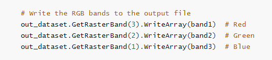
# Write the RGB bands to the output file
out_dataset.GetRasterBand(3).WriteArray(band1) # Red
out_dataset.GetRasterBand(2).WriteArray(band2) # Green
out_dataset.GetRasterBand(1).WriteArray(band3) # Blue
# Set no-data value if present in input
for i in range(1, 4):
nodata = dataset.GetRasterBand(i).GetNoDataValue()
if nodata is not None:
out_dataset.GetRasterBand(i).SetNoDataValue(nodata)
# Flush data and close the output file
out_dataset.FlushCache()
out_dataset = None
dataset = None
print(f"Successfully converted {input_tif} to {output_tif}")
return True
except Exception as e:
print(f"Error during conversion: {str(e)}")
return False
if __name__ == "__main__":
input_file = r"D:\GF2_PMS1-PAN1.tif"
output_file = r"D:\GF2_PMS1-PAN1.tif_rgb.tif"
convert_4band_to_rgb(input_file, output_file)怎么判断是否转换成功
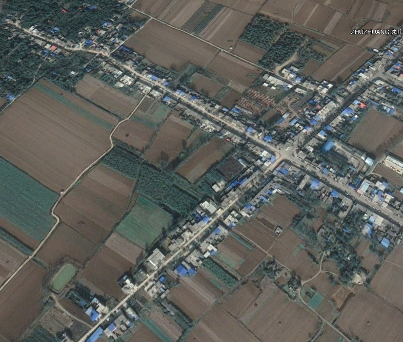
首先,可以成功拖拽到acrgis显示。
其次,我们可以观察地物的颜色是否正常。一般来说,屋顶的颜色大多数是蓝色,尤其是那些较大的建筑物(工厂、仓库)